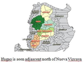
OUR MISSION FIELD
(Southern Isabela, Quirino, Nueva Vizcaya, Ifugao)
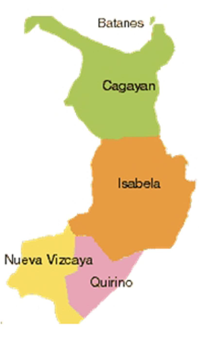
Region II: CAGAYAN VALLEY
(Pointing SOCAVA-COC MISSION Area)
GEOGRAPHICAL LOCATION
![]()
![]()
GEOGRAPHICAL LOCATION
Region II is located at the northern tip of the Philippines. It is composed of five provinces: Batanes, Cagayan, Isabela, Nueva Vizcaya and Quirino. Ifugao is now a part of Cordillera Autonomous Region (CAR) of which a former part of Region II.
POPULATION
In 2000, it had a total population of 2,756,000 In 1995, Isabela had the largest population at 45.8%, Cagayan at 35.29%, Nueva Vizcaya at 13.24%, Quirino at 5.17% and Batanes with the least, at .559% of the total population. In 1990, the population was predominantly rural ,76.5% compared to an urban population of 23.5%.
CULTURAL GROUPS
The original inhabitants of Region II are the ethnic tribes of Ibanags, Gaddangs, ltawis, Yogads and Isnegs.
CLIMATE
The provinces of the region have two seasons: dry from December to May and wet the rest of the year. Average annual rainfall is 2,500 millimeters. Due to the region’s high altitude and the interior position of its valleys, it has greater seasonal changes compared with other regions of the country .
URBAN CENTERS
Region II’s major urban centers are the capital town of Basco in Batanes, Aparri and Tuguegarao in Cagayan, Ilagan, Cauayan, and Santiago in Isabela, Bayombong and Solano in Nueva Vizcaya and Cabarroguis, Diffun and Maddela in Quirino.
FACILITIES
The lack of transportation facilities hinders the development of the region especially in the mountainous areas. Trading is mostly confined to the urban areas of the five provinces. The Region has seaports and airports. Its road network links the provinces. Communication facilities and electricity are available in all five provinces.
PROVINCES OPERATIONS I. Isabela Province
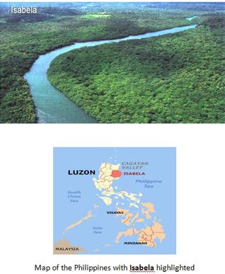
Isabela is the second largest province of the Philippines next to Palawan. It is located in the Cagayan Valley Region in Luzon. Its capital is Ilagan and borders, clockwise from the south, Aurora, Quirino, Nueva Vizcaya, Ifugao, Mountain Province, Kalinga, and Cagayan. This primarily agricultural province is the rice and corn granary of Luzon.
People and culture
According to the latest Philippine Census, Isabela is the most populated province among the five provinces in Cagayan Valley (Region II). It has a population of 1,401,495 people and comprising 45.93 percent of the 3 million people in the region. At the national level, the province contributed 1.58 percent to the total population of 88.57 million. There are 254,928 households in the province.
Ilocanos are the most prominent group in Isabela. Of the total household population, 68.71 percent classified themselves as Ilocanos. The next two prominent groups(ethnic) are Ibanag (14.05 percent) and Tagalog (10.02 percent). The remaining 7.22 percent are either Gaddang, Paranan, Yogad, or are from other ethnic groups.
Geography
Isabela comprises an aggregate land area of 10,665 square kilometers, representing almost 40 percent of the regional territory. It is the largest province in the island of Luzon and the second largest province in the Philippines in terms of land area.Isabela is subdivided into 35 municipalities and 2 cities.
II- Nueva Vizcaya Province
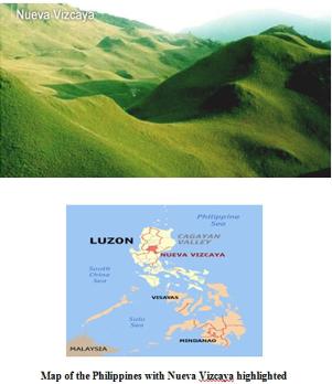
Nueva Vizcaya is a province of the Philippines located in the Cagayan Valley region in Luzon. Its capital is Bayombong. It is bordered by, clockwise from the north, Ifugao, Isabela, Quirino, Aurora, Nueva Ecija, Pangasinan, and Benguet.
Nueva Vizcaya is a mountainous province home to the Mt. Pulog National Park where the country's second highest mountain, Mt. Pulog (3,000 meters), is located. World War 2 memorials include the Dalton Pass and the Kirang Pass. Old Spanish Churches include St. Dominic Cathedral and Dupax del Sur Church. Adventure and eco-tourism sites include the Lion-Alayan Cave and the Kayapa town.
History, people and culture
Since Nueva Vizcaya's birth as a province, traces of the culture and customs of its early settlers—the Ilongots (Bugkalot), Igorots, Ifugaos, Isinays, and the Gaddangs—can still be seen. The influx of civilization and the infusion of modern technology to the life stream of the province induced many immigrants from adjacent provinces to migrate to this province.
Geography
The province has a total land area of 4,378.80 square kilometers, which accounts for 16.30% of the total land area of Region II. It is composed of 15 municipalities, with Bayombong as the provincial capital and major educational center, Bambang and Solano, Nueva Vizcaya as the major commercial centers, and Kayapa as the summer capital and "vegetable bowl." Bayombong lies approximately 268 kilometers north of Metro Manila and can be reached by land via the Cagayan Valley Road (Maharlika Highway).
III- Quirino Province- Forest Heartland Of Cagayan
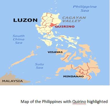
Quirino is a province of the Philippines located in the Cagayan Valley region in Luzon. Its capital is Cabarroguis and was named after Elpidio Quirino, the sixth President of the Philippines. The province borders Aurora to the southeast, Nueva Vizcaya to the west, and Isabela to the north. Quirino used to be part of the province of Nueva Vizcaya, until it was separated in 1966.
Quirino Province is known for its natural sites, wildlife and adventure. Natural sites include the Bisangal Waterfalls, Victoria Falls, the Nagbukel and Aglipay Caves and Nagtipunan virgin rainforest. Governor Rapids is an ideal spot for white water rafting, swimming and fishing.
Profile
Carved from out of the region where the headwaters of Cagayan River descend to the Cagayan plains, Quirino is the newest of the five provinces in Cagayan Valley. It composes the municipalities of Aglipay, Cabarroguis, Diffun, Maddela, Nagtipunan and Saguday. The province lies in the southern portion of Cagayan Valley, bounded by Isabela on the north, Aurora on the southeast and Nueva Vizcaya on the west. The Sierra Madre Mountain Range runs along the border with Aurora while the Caraballo Range dominates the southwest. About 80% of its area is mountainous. The flat lands of the northwest form part of the Cagayan Valley plains. It is here that the main population centers are found. There is no marked rainy season although the province is dry between the months of December and May.
History
Quirino province acquired its juridical personality as a result of the division of the provinces of Nueva Vizcaya and Isabela on June 18, 1966 under RA 4734. Quirino, named after the late president Elpidio Quirino, was created as a sub-province of Nueva Vizcaya in 1966. It became a full province in 1971.
On June 21, 1969, RA 5554 was enacted, amending RA 4734 and creating the municipality of Cabarroguis, now the capital town of Quirino, which was taken from portions of Diffun, Saguday, and Aglipay.
RA 6394 was passed on September 10, 1971 further amending RA 5554 and separating the sub-province of Quirino from its mother province, Nueva Vizcaya, constituting it into a regular province. Hon. Leonardo B. Perez authored RA 6394.
The province of Quirino was formally established on February 10, 1972 upon the assumption to office of the first elected provincial and municipal officials headed by Dionisio A. Sarandi as Provincial Governor.
People, Culture and Arts
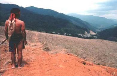
The Ilocanos form the majority of the people living in the province and are concentrated in the lowland plains in Quirino north and northeast. The Ilongots today occupy the hinterlands and along the reaches of the Cagayan River. Ifugaos are evenly distributed in all municipalities of Quirino and there are also Kankana-ey and Inibaloi populations within the province. The Agtas live in the mountains of the Sierra Madre Range.
The Bugkalot ethnic community, an Ilongot tribal village of formerly fierce headhunters living in the upper reaches of Nagtipunan, has constant interaction with the lowlanders of Quirino and is one of the few communities that can be reached readily. Ilongot communities are widely scattered and generally small units of from 50 to 70 members. Fewer that 5,000 Ilongots are believed to live in the mountain fastness of Quirino.
IV- IFUGAO PROVINCE
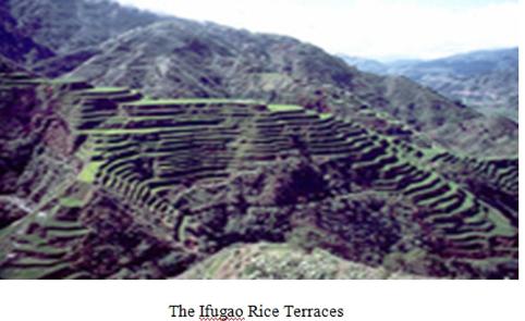
Ifugao is best known for its rice terraces that were constructed 2,000 years ago by the Ifugao tribe using their bare hands and wood as tools. Historic sites include the Philippine War Memorial Shrine at Kiangan, the National Museum, the surrender site of Yamashita and rice wine making in Kiangan. Natural attractions include the Nahtoban and Bintakan Caves, Ahin, ducligan and Tukukan Hot Springs, Amuyao, Napulawan and Anapawon Mountains, and Tappiya and Buyukan Waterfalls.
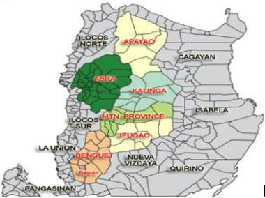
Ifugao is a landlocked province of the Philippines in the Cordillera Administrative Region in Luzon. Covering a total land area of 262,820 hectares, the province of Ifugao is located in a mountainous region characterized by rugged terrain, river valleys, and massive forests. Its capital is Lagawe and borders Benguet to the west, Mountain Province to the north, Isabela to the east, and Nueva Vizcaya to the south.
History
Ifugao was formerly a part of the old Mountain Province. It was created as an independent province on June 18, 1966 by virtue of Republic Act No. 4695.
For the Ifugaos, custom is the basis of all laws. But these customs would mean nothing if not supported by ancestry knowledge. Among the Ifugaos, extensive pedigrees exist. They are the graphic representation that puts in evidence one of the most basic principles of the Ifugao culture: "We can not but do what our ancestors told us"
Ifugao became the center of warfare during the last stages of World War II. It was in Ifugao, particularly in Mt. Napulawan, where General Yamashita, the known "Tiger of Malaya", decided to put his last stand against the Filipino and American forces. Captured by Ifugao warriors, he informally surrendered to Captain Grisham of the 6th US Army in the Philippines, based in Kiangan, before he was flown to Camp John Hay, where he formally surrendered.
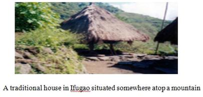
People and culture The Ifugaos typically build their houses at the edge of their fields. A distinctive aspect of these houses is the post just below the floor beams to keep rats from climbing into the house.
Aside from their rice terraces, the Ifugaos are known for their literary traditions of the 'hudhud' and the 'alim.' The term "Ifugao" is derived from "ipugo" which means earth people or mortals or humans, as distinguished from spirits and deities. It also means "from the hill," as "pugo" means hill. The Ifugaos' highest prestige feasts are the "hagabi," for the most wealthy; and the "uyauy," a feast for those immediately below the wealthiest.
The term "Ifugao" refers to the people, their languages, and the province where they live, in the mountainous northern part of the Philippines. They are known as an independent, agricultural society. They speak various Ifugao languages, such as Tuwali and Ayangan.
The people prefer to be called Ifugaos ("people of the earth"), as opposed to the more generic and less accurate term "Igorot" that includes all the peoples of the Cordillera Region, which specifically refers to some of the inhabitants of Benguet.
Rice culture
Ifugao culture revolves around the rice, which is considered a prestige crop. There is an elaborate and complex array of rice culture feasts inextricably linked with taboos and intricate agricultural rites, from rice cultivation to rice consumption. Harvest season calls for grandiose thanksgiving feasts, while the concluding harvest rites "tungo" or "tungul" (the day of rest) entail a strict taboo of any agricultural work. Partaking of the rice beer (bayah), rice cakes, and betel nut is an indelible practice during the festivities and ritual activities.
PLACES WHERE OUR CHURCHES LOCATED:
1. The DIFFUN CHURCH OF CHRIST Quantum Bldg., Andres Bonifacio
Diffun, Quirino Province
Brief History:
Founded in 2002, now attended by an average of twenty to thirty people during Sundays. It hosts the Quirino Christian Students Fellowship of which its wednesday activities being attended by both college and high school students ranging attendance from twenty to forty students every meeting.
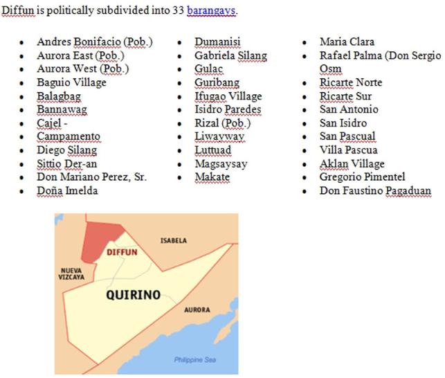
Diffun is a 3rd class municipality in the province of Quirino, Philippines. According to the latest census, it has a population of 42,958 people in 8,274 households.